SANTORY
In 1650 CE, the Greek island of Santorini was devastated by the eruption of an underwater volcano called Kolumbo. People first noticed the water boiling and changing color and a cone poking out of the surface of the sea. Next came ejected glowing rocks, fire and lightning, fumes of thick smoke, falling pumice and ash, earthquakes, and a powerful tsunami with waves as high as 20 meters. All this eruptive activity killed around 70 people and hundreds of cattle.
These details are based on contemporary accounts compiled by French geologist Ferdinand A. Fouqué in 1879. A team of German and Greek scientists has now combined that historical knowledge with 3D seismic mapping and computer simulations to determine why the volcano’s violent eruption triggered a tsunami. According to a new paper published in the journal Nature Communications, the tsunami resulted from a landslide followed by the volcanic explosion.
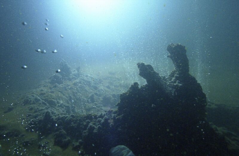
Located some 8 kilometers northeast of Santorini, Kolumbo also erupted around 1630 BCE with catastrophic consequences for ancient Minoan culture. Today, the volcano boasts sulfide-sulfate hydrothermal vents that are home to some rare species of microorganisms typically not found elsewhere near hydrothermal vents. And it remains active and potentially dangerous: A previously unknown magma chamber was discovered last year and is growing at a rate of around 4 million cubic meters per year. At that rate, the chamber will reach the same volume as the amount of magma ejected in the 1650 eruption within the next 150 years.

J. Karstens et al., 2023
A 2016 study concluded that the 1650 tsunami that hit Santorini was most likely the result of a large water displacement generated by an underwater explosion on September 29 of that year, as the volcanic eruption was transitioning between its first phase (almost completely submarine-driven) and second phase. But this latest study paints a more complicated picture.
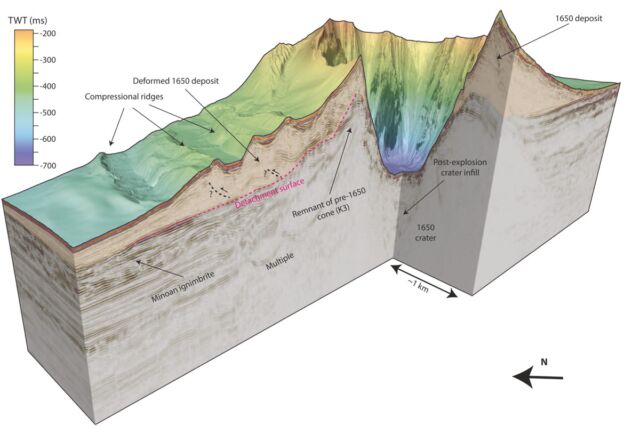
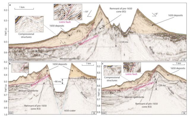
The team made use of the research vessel POSEIDON (since decommissioned) to create a 3D image of the crater, revealing that it is about 500 meters deep and 2.5 kilometers across—evidence of a massive explosion. Also, they noted that one flank of the cone was severely deformed, almost certainly because that part of the volcano had slipped, according to co-author Gareth Crutchley of GEOMAR Helmholtz Centre for Ocean Research Kiel. The next step was to run computer simulations comparing the various likely mechanisms with historical eyewitness accounts.
The simulations showed that waves generated by a volcanic explosion alone would have been 6 meters high at one particular location, but this conflicted with eyewitness accounts from that same location describing much higher waves of 20 meters. That simulation also showed a wave crest reaching the coast first, contradicting historical accounts that the water first receded at that point before the tsunami rushed in. Computer simulations of just the landslide effects also didn’t match historical accounts.
It was only when the simulations combined the explosion and the landslide that they produced effects consistent with historical records. Last year’s eruption of the Hunga Tonga underwater volcano—the most powerful since the 1883 eruption of Krakatoa—caused several tsunamis. Its crater is similarly shaped, and the authors suggest that a similar combined mechanism could have caused those tsunamis as well.

“Kolumbo consists partly of pumice with very steep slopes,” said co-author Jens Karstens, also with GEOMAR Helmholtz Centre for Ocean Research Kiel. “It is not very stable. During the eruption, which had been going on for several weeks, lava was continuously ejected. Underneath, in the magma chamber, which contained a lot of gas, there was enormous pressure. When one of the volcano’s flanks slipped, the effect was like uncorking a bottle of champagne: The sudden release of pressure allowed the gas in the magma system to expand, resulting in a huge explosion.”
Kolumbo and similar active shallow underwater volcanoes are monitored sporadically, but per the authors, current monitoring techniques would not pick up rapidly developing deformed flanks vulnerable to landslides akin to what happened with Kolumbo in 1650. “Local populations, decision-makers, and scientists are currently unprepared for the threats posed by submarine eruptions and slope failures, as has been demonstrated by the recent 2018 sector collapse of Anak Krakatau and the 2022 [Hunga Tonga] eruption,” they wrote. Karstens et al. hope to develop new continuous monitoring approaches based on their new data to create an early warning system that would give populations more time to evacuate to safety.
Nature Communications, 2023. DOI: 10.1038/s41467-023-42261-y (About DOIs).


